INSTITUTIONAL NEWS
The CONICET inaugurated the Argentine-German Geodetic Observatory (AGGO)
Located at the IAR premises, the Observatory has new measurement instrumentation that will be part of the global infrastructure to observe the Earth.
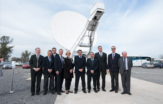
In the presence of the Dr. Roberto Salvareza, president of the National Scientific and Technical Research Council, the Argentine – German Geodetic Observatory (AGGO) was inaugurated. It is located 800 metres from the premises of the Instituto Argentino de Radioastronomía (IAR) [Argentine Institute of Radio Astronomy], under the scope of the CONICET and belongs to the Comisión de Investigaciones Científicas (CICPBA) [Scientific Research Commission].
The event was also attended by the minister of Science, Technology and Productive Innovation, Dr. Lino Barañao; the State Secretary at the Federal Ministry of the Interior of Germany, Cornelia Rogall- Grothe; the German Ambassador to Argentina, Graf von Waldersee; the president of the Federal Agency for Cartography and Geodesy of Germany (BKG), Dr. Hansjörg Kutterer, the director of AGGO operations, Dr. Hayo Hase, the main scientific coordinator of the AGGO project, Prof. Claudio Brunini; the minister of Production, Science and Technology of the province of Buenos Aires; Dr. Cristian Breitestein, the CIC president, Eng. José María Rodríguez Silveira; the president of the Universidad Nacional de La Plata [National University of La Plata], Raúl Perdomo and CONICET authorities.
“Four years ago, I witnessed the beginning of this project when we started the negotiations with the BKG, and I am aware of the effort that allowed us to have this observatory that places Argentina in the geodesic system in the world”, Dr. Salvarezza stated.
Likewise, the president of the Council mentioned that one third of the production of the CONICET is conducted within the framework of international cooperation and highlighted the role played by Germany in that percentage of cooperation with Argentina, in different stages: through the Instituto de Investigación en Biomedicina de Buenos Aires (CONICET – Max Planck Partner Institute of Germany), the Laboratorio Max Planck de Biología Estructural, Química y Biofísica Molecular de Rosario (MPLbioR), and the new observatory.
For his part, Lino Barañao, highlighted the symbolic value of the project and the international cooperation involved: “Congratulations to the CONICET and its German counterpart, and to all the people who promote science diplomacy as the interaction between different countries based on science is the best solution to the current fundamentalism, which only separates.”
The State Secretary at the Federal Ministry of the Interior of Germany spoke about the history of the observatory since its creation to the installation at the CIC premises and said that “it is very significant to have been able to open this laboratory here to agree on global frameworks for sustainable development as there are not so many observatories in the southern hemisphere.”
Besides, the president of the Federal Agency for Cartography and Geodesy of Germany (BKG) stated: “Due to its facilities and location, the AGGO is a station that will be a fundamental element of the global geodesy. We are glad to have found a partner that values the importance of geodesy, which is the measurement and projection of the Earth surface, with the necessary modernization process and substantial changes resulting from technology advances.”
“We celebrate the integration of Argentina into this global project that will help to find solutions to global problems”, the German Ambassador to Argentina said. Finally, the main scientific coordination of the AGGO project commented that modern geodesy has underwent diverse changes throughout is long history and now scientists study a planet that is “alive: the oceans move, there are earthquakes, volcanoes, storms. This observatory will protect the planet and provide the global community with information.”
After the speeches, the authorities performed the ribbon cutting ceremony, presented the inauguration plaque and conducted a tour of the facilities, observing the different measurement instruments.”
The AGGO is a joint contribution to the international network of geodesic instruments provided by Argentina and Germany. It tolerates the global infrastructure of spatial information and contributes to the monitoring of tectonic processes and global change. The observatory was developed and built in Germany. It required an investment of EUR $20 millions whereas the infrastructure was provided by the CONICET, which invested ARS $10 millions.
History of the project
The AGGO is a Fundamental Geodesic Observatory because it has all the measurement techniques of modern Geodesy: a radio telescope for Very Long Baseline Interferometry; a laser telescope for telemetry data on artificial satellites, several signal receivers of navigation global systems supported by satellites, high Precision Gravimeters (absolute and superconducting), atomic clocks (Cesium, Rubidium and Hydrogen Maser), seismographs, meteorological and hydrological sensors, etc. The AGGO provides six international scientific services: Earth Rotation and Reference Systems, Laser Telemetry to Satellites, Global Navigation Supported by Satellites, Gravity Field and The International Bureau of Weights and Measures (BIPM).
The use of the AGGO involves the development of three lines of complementary action. Firstly, the one that is required to operate the Observatory in close cooperation with international organizations that use similar observatories in other parts of the world, everything under the coordination of the International Association of Geodesy. In order to follow this line of action, the AGGO has a staff of four scientists (two provided by the CONICET and two by the BKG), five engineers and eight technicians (all from the CONICET) who settled in the Observatory and with full time dedication.
The second line of action is the one necessary to turn the data obtained by the AGGO into useful products for the Spatial Data Infrastructure of the country. In this field, the AGGO will work in cooperation with the National Geographic Institute and other government organizations committed to the generation and administration of spatial information (such as the parcel and mining provincial cadastrals, Argentine Hydrographic Service, Geological and Mining Service of Argentina, National Institute for Seismic Prevention, the National Institute for Fisheries Development, National Commission on Space Activities, etc.).
The last line of research is the one that is needed to turn the AGGO information into valuable products for the national and international scientific community. In this field, the AGGO has the support of CONICET researchers – professors at the UNLP- and fellows.
The objectives of the AGGO include the motivation of the Argentine scientific community linked to Geodesy, settled in different institutions and regions of the country for the scientific and educational use of the information obtained at the Observatory.
To watch the video click here